New Coding4Fun Article - Where the Heck am I?
Sponsored By
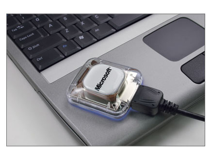 In this third installment of the "Some Assembly Required" column, I connect to the GPS that came with Microsoft Streets and Trips 2005. I upgraded EdJez's .NET 1.1 application to .NET 2.0 and explores the process and 2.0 benefits and learned more than I wanted about the NMEA GPS data specification. I cover System.IO.Ports, generics collection classes, and revel in the WinForms 2.0 designer. Enjoy!
About Scott
Scott Hanselman is a former professor, former Chief Architect in finance, now speaker, consultant, father, diabetic, and Microsoft employee. He is a failed stand-up comic, a cornrower, and a book author.
About Newsletter
Hosting By


I think you buy it direct from Pharos...but why not just spend the few bucks more and get the maps?

The reason is I write GIS mapping applications for a living and I have more mapping stuff then anyone could possibly need in one lifetime.
Data that is so accurate and so detailed that sometimes looking at streets and trips is painfull for me. Nothing against Streets and Trips it does what it was intended to do very well. Which is be routeware.
I need GIS stuff which is completely different. MSFT gets the data in Streets and Trips from two companies one is called Navtech, the other is called TeleAtlas. I already have that data I get it every three months.
The reason I want the GPS is because it's USB powered yet acts like a virtual serial port. Have you ever messed with writing USB drivers? It's a royal pain but doable. Serial port connections are way easier and 100 bucks for a GPS is dirt cheap.
However I will probably end up needing a couple hundred of them when I'm done and I don't need 1 copy of Streets and Trips let alone 100+. I have an existing mapping program that could really use GPS ability I just don't like the GPS that most people currently use for doing what I want to do. That GPS is made by DeLorme and they have a sh!tty developer program and their stuff primarily uses Sirf binary protocol over USB not NMEA strings. For what I want to do Sirf has more info than I need plus I hate doing the conversions(Sirf gives you your position as a location based on the earth's center and you have to convert that to lat, lon).
NMEA strings would be perfect for what I'm doing and I already have the code to parse them from other things I've done. I have Sirf too but NMEA is easier for what I want to do and I don't need to control the receiver just retrieve position.
I could talk GIS systems and GPS stuff all day but that is essentially why I want just the reciever and drivers not the Software. I wrote a mapping application once that has twenty times the functionality(not bragging, it really does) of Streets and Trips and my company patented it. If I see you at one of the nerd dinners remind me and I'll show it to you in it's handheld version. I think you'll like it so far everyone I've shown it to thinks it's pretty neat.

Scott, very cool article - I have that same s+t+gps but at the ms store price which is an even better deal!
One thing though - your satellite custom painting, which is very cool btw, looks very much like the portege application for finding wifi hotspots! Coincidence?!
One thing though - your satellite custom painting, which is very cool btw, looks very much like the portege application for finding wifi hotspots! Coincidence?!

Andy, buy 1 copy of strets and trips and then the other 99 units direct from Pharos..
Comments are closed.
Do you know of any place you can buy just the GPS and the install stuff needed to get it set up as a virtual serial port?